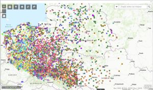
Atlas of Monasteries in Poland, 10th-21st Centuries
The Atlas of monasteries in Poland X-XXI c. was prepared by the Institute for the Historical Geography of the Church in Poland as part of a project financed by the Ministry of Science and Higher Education. The atlas includes all monastic orders and their religious houses (monasteries) that existed in the Polish lands from the adoption of Christianity in 966 until the present day. The work is headed by Prof. Henryk Gapski, PhD. Currently, the database contains more than 11,000 objects of male and female orders, and the database will be made available to a wide range of researchers of monastic issues, regionalists and all people interested in the history of the Church, monasteries after the project closes at the end of 2024. Often these monasteries were historical and historic sites. An undoubted advantage of the project will also be the presentation of sites that existed in the past and have not survived to the present day. The team of authors carrying out the project has made every effort to reconstruct the location of these places with the greatest possible precision. For this purpose, a group of eminent specialists, experts in the history of the Catholic, Uniate and Orthodox Church orders, was recruited to cooperate. he digital component of the atlas has been prepared in cooperation with GIS-Expert and this company will be responsible for the final appearance and functionality of the atlas. In addition, a publication is planned, which will contain basic information about all the orders registered in the database, as well as an index of all the monasteries.

