Atlas of the Latin Church in the Polish-Lithuanian Commonwealth in the Eighteenth Century
Link to the app
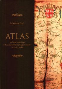
The Atlas of the Latin Church in the Polish-Lithuanian Commonwealth in the Eighteenth Century application was developed by the Institute for the Historical Geography of the Church in Poland on the basis of data published in the work of S. Litak with the same title (TNKUL, Lublin 2006). The original database by B. Szady was created in 1993-1996 prior to the publication of the previous edition of Litak's study[1]. The work carried out over the next decade resulted in expanding the pool of sources as well as making necessary additions and corrections. At the same time, a map was prepared and editorial changes regarding the system of source and bibliographic abbreviations were made.
The information presented in the application and the downloadable files is grouped into 4 sections: 1) churches, 2) monasteries and convents, 3) ecclesiastical boundaries, and 4) secular boundaries. The whole resource has been provided with appropriate metadata and a list of abbreviations.
Metadata and data to download
Churches
- WFS Service:
- GeoJSON:
https://geo-ecclesiae.kul.pl/data/latin-church-1772/churches.geojson
- GeoPackage:
https://geo-ecclesiae.kul.pl/data/latin-church-1772/churches.gpkg
- KML:
https://geo-ecclesiae.kul.pl/data/latin-church-1772/churches.kml
- XLSX:
https://geo-ecclesiae.kul.pl/data/latin-church-1772/churches.xlsx
| Date: | 2020 |
|---|---|
| Last update (day): | 15 March 2024 |
| Creator: | Institute for the Historical Geography of the Church in Poland KUL |
| Language: | pl |
| Character set: | UTF-8 |
| License: | CC BY-NC |
| Reference system: | EPSG 3857 |
| BBOX: | 1600265.50,5645599.00,3712955.00,7929436.50 |
| Topology: | polygon |
| ob_id | unique identifier, object id |
|---|---|
| diocese | name of a diocese |
| adeaconry | name of a archdeaconry |
| deanery | name of a deanery |
| type | type of a church [świątynia główna (pl), main church - parish church (en); świątynia pomocnicza (pl), auxiliary church - filial church or public chapel (en)] |
| pl_type | type of a settlement unit [miasto (pl), town, city (en); wieś (pl), village (en)] |
| pl_name | main name of a place (a locality) |
| pal_name | name of a palatinate (see list of abbreviations) |
| title | title of a church, name of a church (see list of abbreviations) |
| parish | parochial affiliation of a auxiliary church |
| source | source documentation (see list of abbreviations) |
| material | type of building material (see list of abbreviations) |
| kind | kind of a church (see list of abbreviations) |
| patronage | type of patronage (see list of abbreviations) |
| pl_name_de | name of a place (german), especially in western and northern zones |
| pl_name_v | name of a place (variants) |
| comment | remarks and comments |
| ObjectId | serial number |
Monasteries
- WFS Service:
- GeoJSON:
https://geo-ecclesiae.kul.pl/data/latin-church-1772/monasteries.geojson
- GeoPackage:
https://geo-ecclesiae.kul.pl/data/latin-church-1772/monasteries.gpkg
- KML:
https://geo-ecclesiae.kul.pl/data/latin-church-1772/monasteries.kml
- XLSX:
https://geo-ecclesiae.kul.pl/data/latin-church-1772/monasteries.xlsx
| Date: | 2020 |
|---|---|
| Last update (day): | 15 March 2024 |
| Creator: | Institute for the Historical Geography of the Church in Poland KUL |
| Language: | pl |
| Character set: | UTF-8 |
| License: | CC BY-NC |
| Reference system: | EPSG 3857 |
| BBOX: | 1701831.03,6160432.27,3564387.49,7789414.89 |
| Topology: | point |
| ob_id | unique identifier, object id |
|---|---|
| name | name of an order |
| pl_type | type of a settlement unit [miasto (pl), town, city (en); wieś (pl), village (en)] |
| pl_name | main name of a place (a locality) |
| pal_name | name of a palatinate (see list of abbreviations) |
| diocese | name of a diocese |
| title | title of a monastery church, name of a monastery church (see list of abbreviations) |
| source | source documentation (see list of abbreviations) |
| category | category of a monastery house (m - male, z - female) |
| province | name of a province |
| kind | kind a monastery house or of a monastery church (see list of abbreviations) |
| pl_name_v | name of a place (variants) |
| pl_name_de | name of a place (German), especially in the West and the North |
| s_province | name of a subprovince (e.g. custody) |
| comment | remarks and comments |
| ObjectId | serial number |
Catholic boundaries
- WFS Service:
- GeoJSON:
https://geo-ecclesiae.kul.pl/data/latin-church-1772/catholic_boundaries.geojson
- GeoPackage:
https://geo-ecclesiae.kul.pl/data/latin-church-1772/catholic_boundaries.gpkg
- KML:
https://geo-ecclesiae.kul.pl/data/latin-church-1772/catholic_boundaries.kml
- XLSX:
https://geo-ecclesiae.kul.pl/data/latin-church-1772/catholic_boundaries.xlsx
| Date: | 2020 |
|---|---|
| Last update (day): | 15 March 2024 |
| Creator: | Institute for the Historical Geography of the Church in Poland KUL |
| Language: | pl |
| Character set: | UTF-8 |
| License: | CC BY-NC |
| Reference system: | EPSG 3857 |
| BBOX: | 1600265.50,5645599.00,3712955.00,7929436.50 |
| Topology: | polygon |
| area_id | unique identifier, area id |
|---|---|
| deanery_id | identifier of a deanery |
| deanery | name of a deanery |
| adeacon_id | identifier of a archdeaconry |
| adeaconry | name of a archdeaconry |
| diocese_id | identifier of a diocese |
| diocese | name of a diocese |
| metrop_id | identifier of a metropolitan province |
| metropoly | name of a metropolitan province |
| ObjectId | serial number |
Secular boundaries
- WFS Service:
- GeoJSON:
https://geo-ecclesiae.kul.pl/data/latin-church-1772/secular_boundaries.geojson
- GeoPackage:
https://geo-ecclesiae.kul.pl/data/latin-church-1772/secular_boundaries.gpkg
- KML:
https://geo-ecclesiae.kul.pl/data/latin-church-1772/secular_boundaries.kml
- XLSX:
https://geo-ecclesiae.kul.pl/data/latin-church-1772/secular_boundaries.xlsx
| Date: | 2020 |
|---|---|
| Last update (day): | 15 March 2024 |
| Creator: | Institute for the Historical Geography of the Church in Poland KUL |
| Language: | pl |
| Character set: | UTF-8 |
| License: | CC BY-NC |
| Reference system: | EPSG 3857 |
| BBOX: | 1610724.49,5656905.46,3702496.14,7918130.10 |
| Topology: | polygon |
| id | unique identifier, area id |
|---|---|
| palat_id | identifier of a palatinate or of an another civil administrative unit |
| pal_name | name of a palatinate (see list of abbreviations) |
| ObjectId | serial number |
Research work and application supported by the state funding under project NPRH/DN/SP/495771/2021/10.
- ↑ "The Latin Church in the Polish-Lithuanian Commonwealth around 1772: Administrative Structures", Institute of East-Central Europe, Lublin 1996, Religious and Ethnic Communities in the Polish-Lithuanian Commonwealth in the Second Half of the 18th Century, 1.


