Geo-ecclesiae (English Version)
This is the research data page of the Institute for Historical Geography of the Church in Poland, which is the main centre for the study of the history and spatial organization of the Catholic Church and other Christian denominations in the areas of Poland and the Polish-Lithuanian Commonwealth.
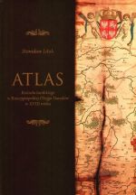
Atlas of the Latin Church in the Polish-Lithuanian Commonwealth in the Eighteenth Century
The Atlas of the Latin Church in the Polish-Lithuanian Commonwealth in the Eighteenth Century application was developed by the Institute for Historical Geography of the Church in Poland on the basis of data published in the work of S. Litak with the same title (TNKUL, Lublin 2006). The original database by B. Szady was created in 1993-1996 prior to the publication of the previous edition of Litak's study[1]. The work carried out over the next decade resulted in expanding the pool of sources as well as making necessary additions and corrections. At the same time, a map was prepared and editorial changes regarding the system of source and bibliographic abbreviations were made.
The information presented in the application and the downloadable files is grouped into 4 sections: 1) churches, 2) monasteries and convents, 3) ecclesiastical boundaries, and 4) secular boundaries. The whole resource has been provided with appropriate metadata and a list of abbreviations.
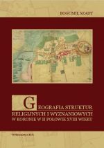
Religions and Denominations in the (Polish) Crown in the Second Half of the Eighteenth Century
The map is based mainly on sources and studies providing systematic information on the structures and distribution of temples and places of worship. It covers a total of 15,253 religious buildings, including 8311 Uniate, 5720 Latin, 841 Jewish, 276 Lutheran, 35 Orthodox, 22 Catholic of Armenian rite, 19 Mennonite, 14 Calvinist, 10 Czech Brethren, 3 Karaite and 2 Islamic ones.
The information presented in the application and in the downloadable files is grouped into 2 sections: 1) temples and places of worship, 2) borders. The entire resource has been provided with appropriate metadata and a list of abbreviations. You can also download the 2010 book Geografia struktur religijnych i wyznaniowych w Koronie w II połowie XVIII w. (Geography of Religious and Confessional Structures in the (Polish) Crown in the Second Half of the Eighteenth Century) by B. Szady from the application website.
Territorial Structure of the Latin Church before World War II
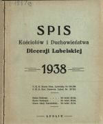
The Territorial structure of the Latin Church before World War II application was developed by the Institute for the Historical Geography of the Church in Poland based on information contained in diocesan schematisms issued before World War II. The database was built using the INDXR tool (ver. 2.0), which is used to annotate historical sources while maintaining the link between scans and the database. Two schematisms were selected for each diocese: a basic one from 1938 and a second, supplementary one from 1936-1939. It was not possible to find the schematism of the diocese of Częstochowa from 1938 and it was decided to use the schematisms of this diocese from the years 1937 and 1939. The criterion for choosing the supplementary schematism was determined by the information content and its characteristics (completeness of information about parish churches, their titles, building materials, etc.).
In total, 21,507 objects from 42 diocesan schematisms covering 21 dioceses belonging to 5 metropolises: Gniezno-Poznań, Warsaw, Kraków, Lwów (Lviv) and Wilno (Vilnius) were indexed. After analyzing the information, the resulting table of parishes included 5,184 records. In addition to establishing descriptive attributes (place name, title of church, building material, deanery and diocesan affiliation), it was also necessary to situate the seat of each parish. This was done on the basis of cartographic sources from the first half of the twentieth century, mainly the 1:100 000 scale maps of the Military Geographical Institute. The affiliation of each church with the appropriate deanery and diocese made it possible to prepare a drawing of boundaries (areas). The spatial data was compiled in QGIS software and published on ArcGIS Online platform.
- ↑ "The Latin Church in the Polish-Lithuanian Commonwealth around 1772: Administrative Structures", Institute of East-Central Europe, Lublin 1996, Religious and Ethnic Communities in the Polish-Lithuanian Commonwealth in the Second Half of the 18th Century, 1.


