Territorial structure of the Latin Church before World War II: Difference between revisions
No edit summary |
No edit summary |
||
| (7 intermediate revisions by the same user not shown) | |||
| Line 1: | Line 1: | ||
[[pl:Struktura_terytorialna_Kościoła_łacińskiego_przed_II_wojną_światową]] | [[pl:Struktura_terytorialna_Kościoła_łacińskiego_przed_II_wojną_światową]] | ||
= | [[File:Logo OBnGHKwP.jpg|210x210px|link=Ośrodek_Badań_nad_Geografią_Historyczną_Kościoła_w_Polsce|right|frameless]] | ||
[[File:Schematyzmy.jpg|right|frameless|253x253px]] | |||
== | == [https://geo-ecclesiae.kul.pl/apps/latin-church-1938/ Link to the app] == | ||
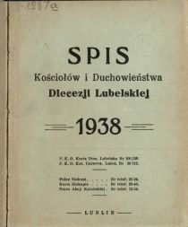
'''[https://geo-ecclesiae.kul.pl/apps/latin-church-1938/ The application “Territorial structure of the Latin Church before World War II”]''' was prepared by the Institute for the Historical Geography of the Church in Poland based on information contained in diocesan schematisms issued before World War II. The database was developed using the INDXR tool (ver. 2.0), which is used to annotate historical sources, while maintaining the link between scans and the database. Two schematisms were selected for each diocese: the basic one from 1938 and the second, supplementary one from 1936-1939. It was not possible to find the schematism of the diocese of Częstochowa from 1938 and it was decided to use the schematisms of this diocese from the years 1937 and 1939. The criterion for choosing supplementary schematism was determined by the information content and its characteristics (completeness of information about parish churches, their titles, building materials, etc.). | |||
In total, 21 507 objects from 42 diocesan schematisms covering 21 dioceses belonging to 5 metropolises: Gniezno-Poznań, Warsaw, Kraków, Lwów (Lviv) and Wilno (Vilnius) were indexed. After analyzing the information, the resulting table of parishes included 5184 records. In addition to establishing descriptive attributes (place name, title of church, building material, deanery and diocesan affiliation), it was also necessary to situate the seat of each parish. This was done on the basis of cartographic sources from the first half of the twentieth century, mainly maps of the Military Geographical Institute (scale of 1:100 000). The affiliation of each church to the appropriate deanery and diocese made it possible to prepare a drawing of boundaries (areas). The spatial data was compiled in QGIS software and published on ArcGIS Online platform. | |||
* | == Metadata and data to download == | ||
==== <u>Churches</u> ==== | |||
* WFS Service: | |||
https://dservices5.arcgis.com/feZdCwP2DrNxyL6T/arcgis/services/churches_1938/WFSServer?service=wfs&request=getcapabilities | https://dservices5.arcgis.com/feZdCwP2DrNxyL6T/arcgis/services/churches_1938/WFSServer?service=wfs&request=getcapabilities | ||
| Line 12: | Line 18: | ||
* GeoJSON: | * GeoJSON: | ||
https://geo-ecclesiae.kul.pl/ | https://geo-ecclesiae.kul.pl/data/latin-church-1938/churches_1938.geojson | ||
* GeoPackage: | * GeoPackage: | ||
https://geo-ecclesiae.kul.pl/ | https://geo-ecclesiae.kul.pl/data/latin-church-1938/churches_1938.gpkg | ||
* KML: | * KML: | ||
https://geo-ecclesiae.kul.pl/ | https://geo-ecclesiae.kul.pl/data/latin-church-1938/churches_1938.kml | ||
* XLSX: | * XLSX: | ||
https://geo-ecclesiae.kul.pl/ | https://geo-ecclesiae.kul.pl/data/latin-church-1938/churches_1938.xlsx | ||
{| class="wikitable" | {| class="wikitable" | ||
! Date: !! 2023 | |||
|- | |- | ||
| Last update (day): || 14 February 2023 | |||
|- | |- | ||
| Creator: || Institute for the Historical Geography of the Church in Poland KUL | |||
|- | |- | ||
| Language: || pl | |||
|- | |- | ||
| Character set: || UTF-8 | |||
|- | |- | ||
| License: || CC BY-NC | |||
|- | |- | ||
| Reference system: || EPSG 3857 | |||
|- | |- | ||
| BBOX: || 1569051.12,6287336.50,2683795.00,7334257.50 | |||
|- | |- | ||
| Topology: || point | |||
|} | |} | ||
{| class="wikitable" | {| class="wikitable" | ||
! id | ! id !! unique identifier | ||
|- | |- | ||
| pl_name | | pl_name || main name of a place (a locality) | ||
|- | |- | ||
| title | | title || title of a church, name of a church (see list of abbreviations) | ||
|- | |- | ||
| deanery | | deanery || name of a deanery | ||
|- | |- | ||
| diocese | | diocese || name of a diocese | ||
|- | |- | ||
| pl_name_v | | pl_name_v || name of a place (variants) | ||
|- | |- | ||
| comments | | comments || comments | ||
|- | |- | ||
| location_g | | location_g || information on object source | ||
|- | |- | ||
| location_i | | location_i || information on object location (website) | ||
|- | |- | ||
| location_w | | location_w || wikidata | ||
|- | |- | ||
| fid | | fid || serial number | ||
|- | |- | ||
| schem_1_date | | schem_1_date || year in which the schematic was published | ||
|- | |- | ||
| schem_1 | | schem_1 || link to scan of the schematic | ||
|- | |- | ||
| schem_2_date | | schem_2_date || year of publication of the supplementary schematism | ||
|- | |- | ||
| schem_2 | | schem_2 || link to the scan of the supplementary schematism | ||
|} | |} | ||
==== <u>Borders | ==== <u>Borders</u> ==== | ||
* | * WFS Service: | ||
https://dservices5.arcgis.com/feZdCwP2DrNxyL6T/arcgis/services/parishes_1938/WFSServer?service=wfs&request=getcapabilities | https://dservices5.arcgis.com/feZdCwP2DrNxyL6T/arcgis/services/parishes_1938/WFSServer?service=wfs&request=getcapabilities | ||
* GeoJSON: | * GeoJSON: | ||
https://geo-ecclesiae.kul.pl/ | https://geo-ecclesiae.kul.pl/data/latin-church-1938/parishes_1938.geojson | ||
* GeoPackage: | * GeoPackage: | ||
https://geo-ecclesiae.kul.pl/ | https://geo-ecclesiae.kul.pl/data/latin-church-1938/parishes_1938.gpkg | ||
* KML: | * KML: | ||
https://geo-ecclesiae.kul.pl/ | https://geo-ecclesiae.kul.pl/data/latin-church-1938/parishes_1938.kml | ||
* XLSX: | * XLSX: | ||
https://geo-ecclesiae.kul.pl/ | https://geo-ecclesiae.kul.pl/data/latin-church-1938/parishes_1938.xlsx | ||
{| class="wikitable" | {| class="wikitable" | ||
! Date: !! 2023 | |||
|- | |- | ||
| Last update (day): || 14 February 2023 | |||
|- | |- | ||
| Creator: || Institute for the Historical Geography of the Church in Poland KUL | |||
|- | |- | ||
| Language: || pl | |||
|- | |- | ||
| Character set: || UTF-8 | |||
|- | |- | ||
| License: || CC BY-NC | |||
|- | |- | ||
| Reference system: || EPSG 3857 | |||
|- | |- | ||
| BBOX: || 1566573.50,6269933.50,2693475.25,7335457.50 | |||
|- | |- | ||
| Topology: || polygon | |||
|} | |} | ||
{| class="wikitable" | {| class="wikitable" | ||
! id | ! id !! unique identifier, area id | ||
|- | |- | ||
| deanery | | deanery || name of a deanery | ||
|- | |- | ||
| diocese | | diocese || name of a diocese | ||
|- | |- | ||
| metropoly | | metropoly || the name of the metropolis | ||
|- | |- | ||
| fid | | fid || serial number | ||
|} | |}__FORCETOC__ | ||
[[Category:Geo-ecclesiae resources]] | |||
[[Category: | [[Category:Institute for the Historical Geography of the Church in Poland]] | ||
[[Category: | |||
Revision as of 14:05, 21 April 2023
Link to the app
The application “Territorial structure of the Latin Church before World War II” was prepared by the Institute for the Historical Geography of the Church in Poland based on information contained in diocesan schematisms issued before World War II. The database was developed using the INDXR tool (ver. 2.0), which is used to annotate historical sources, while maintaining the link between scans and the database. Two schematisms were selected for each diocese: the basic one from 1938 and the second, supplementary one from 1936-1939. It was not possible to find the schematism of the diocese of Częstochowa from 1938 and it was decided to use the schematisms of this diocese from the years 1937 and 1939. The criterion for choosing supplementary schematism was determined by the information content and its characteristics (completeness of information about parish churches, their titles, building materials, etc.).
In total, 21 507 objects from 42 diocesan schematisms covering 21 dioceses belonging to 5 metropolises: Gniezno-Poznań, Warsaw, Kraków, Lwów (Lviv) and Wilno (Vilnius) were indexed. After analyzing the information, the resulting table of parishes included 5184 records. In addition to establishing descriptive attributes (place name, title of church, building material, deanery and diocesan affiliation), it was also necessary to situate the seat of each parish. This was done on the basis of cartographic sources from the first half of the twentieth century, mainly maps of the Military Geographical Institute (scale of 1:100 000). The affiliation of each church to the appropriate deanery and diocese made it possible to prepare a drawing of boundaries (areas). The spatial data was compiled in QGIS software and published on ArcGIS Online platform.
Metadata and data to download
Churches
- WFS Service:
- GeoJSON:
https://geo-ecclesiae.kul.pl/data/latin-church-1938/churches_1938.geojson
- GeoPackage:
https://geo-ecclesiae.kul.pl/data/latin-church-1938/churches_1938.gpkg
- KML:
https://geo-ecclesiae.kul.pl/data/latin-church-1938/churches_1938.kml
- XLSX:
https://geo-ecclesiae.kul.pl/data/latin-church-1938/churches_1938.xlsx
| Date: | 2023 |
|---|---|
| Last update (day): | 14 February 2023 |
| Creator: | Institute for the Historical Geography of the Church in Poland KUL |
| Language: | pl |
| Character set: | UTF-8 |
| License: | CC BY-NC |
| Reference system: | EPSG 3857 |
| BBOX: | 1569051.12,6287336.50,2683795.00,7334257.50 |
| Topology: | point |
| id | unique identifier |
|---|---|
| pl_name | main name of a place (a locality) |
| title | title of a church, name of a church (see list of abbreviations) |
| deanery | name of a deanery |
| diocese | name of a diocese |
| pl_name_v | name of a place (variants) |
| comments | comments |
| location_g | information on object source |
| location_i | information on object location (website) |
| location_w | wikidata |
| fid | serial number |
| schem_1_date | year in which the schematic was published |
| schem_1 | link to scan of the schematic |
| schem_2_date | year of publication of the supplementary schematism |
| schem_2 | link to the scan of the supplementary schematism |
Borders
- WFS Service:
- GeoJSON:
https://geo-ecclesiae.kul.pl/data/latin-church-1938/parishes_1938.geojson
- GeoPackage:
https://geo-ecclesiae.kul.pl/data/latin-church-1938/parishes_1938.gpkg
- KML:
https://geo-ecclesiae.kul.pl/data/latin-church-1938/parishes_1938.kml
- XLSX:
https://geo-ecclesiae.kul.pl/data/latin-church-1938/parishes_1938.xlsx
| Date: | 2023 |
|---|---|
| Last update (day): | 14 February 2023 |
| Creator: | Institute for the Historical Geography of the Church in Poland KUL |
| Language: | pl |
| Character set: | UTF-8 |
| License: | CC BY-NC |
| Reference system: | EPSG 3857 |
| BBOX: | 1566573.50,6269933.50,2693475.25,7335457.50 |
| Topology: | polygon |
| id | unique identifier, area id |
|---|---|
| deanery | name of a deanery |
| diocese | name of a diocese |
| metropoly | the name of the metropolis |
| fid | serial number |


