Religions and Denominations in the (Polish) Crown in the Second Half of the Eighteenth Century: Difference between revisions
No edit summary |
|||
| (9 intermediate revisions by 2 users not shown) | |||
| Line 1: | Line 1: | ||
<skin>Chameleon</skin> | |||
[[pl:Religie_i_wyznania_w_Koronie_w_II_połowie_XVIII_wieku]] | [[pl:Religie_i_wyznania_w_Koronie_w_II_połowie_XVIII_wieku]] | ||
[[ | [[File:Logo OBnGHKwP.jpg|210x210px|link=Ośrodek_Badań_nad_Geografią_Historyczną_Kościoła_w_Polsce|right|frameless]] | ||
[[ | [[File:Szady cover.jpg|right|frameless|300x300px]] | ||
== [https://geo-ecclesiae.kul.pl/apps/confessions-crown-1772/ Link | == [https://geo-ecclesiae.kul.pl/apps/confessions-crown-1772/ Link to the app] == | ||
'''[https://geo-ecclesiae.kul.pl/apps/confessions-crown-1772/ The application "Religions and Denominations in the (Polish) Crown in the Second Half of the Eighteenth Century"]''' is based mainly on sources and studies providing systematic information on the structures and distribution of temples and places of worship. It covers a total of 15,253 religious buildings, including 8311 Uniate, 5720 Latin, 841 Jewish, 276 Lutheran, 35 Orthodox, 22 Catholic of Armenian rite, 19 Mennonite, 14 Calvinist, 10 Czech Brethren, 3 Karaite, and 2 Islamic ones. | |||
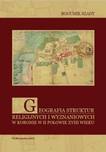
The information presented in the application and in the downloadable files has been grouped into 2 sections: 1) temples and places of worship, 2) borders. The entire resource has been provided with appropriate metadata and a list of abbreviations. From the application page you can also download the book by B. Szady, Geografia struktur religijnych i wyznaniowych w Koronie w II połowie XVIII w. /Geography of Religious and Confessional Structures in the (Polish) Crown in the Second Half of the Eighteenth Century/, Lublin 2010. | |||
== Metadata and data to download == | == Metadata and data to download == | ||
==== <u> | ==== <u>Sacral objects</u> ==== | ||
* | * WFS Service: | ||
https://dservices5.arcgis.com/feZdCwP2DrNxyL6T/arcgis/services/sacral_objects/WFSServer?service=wfs&request=getcapabilities | https://dservices5.arcgis.com/feZdCwP2DrNxyL6T/arcgis/services/sacral_objects/WFSServer?service=wfs&request=getcapabilities | ||
| Line 30: | Line 34: | ||
{| class="wikitable" | {| class="wikitable" | ||
! Date: !! 2020 | |||
|- | |- | ||
| Last update (day): || 23 March 2022 | |||
|- | |- | ||
| Creator: || Institute for the Historical Geography of the Church in Poland KUL | |||
|- | |- | ||
| Language: || pl | |||
|- | |- | ||
| Character set: || UTF-8 | |||
|- | |- | ||
| License: || CC BY-NC | |||
|- | |- | ||
| Reference system: || EPSG 3857 | |||
|- | |- | ||
| BBOX: || 1696775.72,6001119.15,3685543.70,7320440.73 | |||
|- | |- | ||
| Topology: || point | |||
|} | |} | ||
{| class="wikitable" | {| class="wikitable" | ||
! ob_id | ! ob_id !! unique identifier, object id | ||
|- | |- | ||
| pl_name | | pl_name || main name of a place (a locality) | ||
|- | |- | ||
| pl_name_de | | pl_name_de || name of a place (german), especially in western and northern zones | ||
|- | |- | ||
| pl_name_v | | pl_name_v || name of a place (variants) | ||
|- | |- | ||
| pl_type | | pl_type || type of a settlement unit [miasto (pl), town, city (en); wieś (pl), village (en)] | ||
|- | |- | ||
| material | | material || type of building material (see list of abbreviations) | ||
|- | |- | ||
| patronage | | patronage || type of patronage (see list of abbreviations) | ||
|- | |- | ||
| title | | title || title of a church, name of a church (see list of abbreviations) | ||
|- | |- | ||
| denom | | denom || denominational belonging of a place of worship | ||
|- | |- | ||
| source | | source || source documentation (see list of abbreviations) | ||
|- | |- | ||
| pal_name | | pal_name || name of palatinate/voivodeship (see list of abbreviations) | ||
|- | |- | ||
| deanery | | deanery || name of a deanery/protopopy(governorship) | ||
|- | |- | ||
| adeaconry | | adeaconry || name of a archdeaconry (provostship, deaconry)/officialate | ||
|- | |- | ||
| diocese | | diocese || name of a diocese/eparchy | ||
|- | |- | ||
| metropoly | | metropoly || name of a metropolitan province | ||
|- | |- | ||
| type | | type || type of a of a place of worship [świątynia główna (pl), main church - parish church (en); świątynia pomocnicza (pl), auxiliary church - filial church or public chapel (en)] | ||
|- | |- | ||
| parish | | parish || parochial affiliation of a auxiliary church | ||
|- | |- | ||
| kind | | kind || kind of a church (see list of abbreviations) | ||
|- | |- | ||
| name | | name || name of a an order | ||
|- | |- | ||
| ObjectId | | ObjectId || serial number | ||
|} | |} | ||
====<u>Borders | ====<u>Borders</u>==== | ||
* | *WFS Service: | ||
https://dservices5.arcgis.com/feZdCwP2DrNxyL6T/arcgis/services/borders/WFSServer?service=wfs&request=getcapabilities | https://dservices5.arcgis.com/feZdCwP2DrNxyL6T/arcgis/services/borders/WFSServer?service=wfs&request=getcapabilities | ||
| Line 114: | Line 118: | ||
{| class="wikitable" | {| class="wikitable" | ||
! Date: !! 2020 | |||
|- | |- | ||
| Last update (day): || 23 March 2022 | |||
|- | |- | ||
| Creator: || Institute for the Historical Geography of the Church in Poland KUL | |||
|- | |- | ||
| Language: || pl | |||
|- | |- | ||
| Character set: || UTF-8 | |||
|- | |- | ||
| License: || CC BY-NC | |||
|- | |- | ||
| Reference system: || EPSG 3857 | |||
|- | |- | ||
| BBOX: || 1685719.62,5992125.00,3712146.50,7337003.50 | |||
|- | |- | ||
| Topology: || polygon | |||
|} | |} | ||
{| class="wikitable" | {| class="wikitable" | ||
! id | ! id !! unique identifier | ||
|- | |- | ||
| cat_dioces | | cat_dioces || name of Latin dioceses | ||
|- | |- | ||
| cat_adeaco | | cat_adeaco || name of the Latin archdeaconry | ||
|- | |- | ||
| cat_deaner | | cat_deaner || name of Latin deaneries | ||
|- | |- | ||
| uni_dioces | | uni_dioces || the name of the Uniate dioceses | ||
|- | |- | ||
| uni_adeaco | | uni_adeaco || the name of the Uniate archdeaconries | ||
|- | |- | ||
| uni_deaner | | uni_deaner || name of Uniate deaneries | ||
|- | |- | ||
| palat_name | | palat_name || name of palatinate/voivodeship | ||
|- | |- | ||
| comment | | comment || remarks and comments | ||
|- | |- | ||
| ObjectId | | ObjectId || serial number | ||
|} | |} | ||
[[Category:Institute for the Historical Geography of the Church in Poland]] | |||
Latest revision as of 18:11, 26 April 2024
Link to the app
The application "Religions and Denominations in the (Polish) Crown in the Second Half of the Eighteenth Century" is based mainly on sources and studies providing systematic information on the structures and distribution of temples and places of worship. It covers a total of 15,253 religious buildings, including 8311 Uniate, 5720 Latin, 841 Jewish, 276 Lutheran, 35 Orthodox, 22 Catholic of Armenian rite, 19 Mennonite, 14 Calvinist, 10 Czech Brethren, 3 Karaite, and 2 Islamic ones.
The information presented in the application and in the downloadable files has been grouped into 2 sections: 1) temples and places of worship, 2) borders. The entire resource has been provided with appropriate metadata and a list of abbreviations. From the application page you can also download the book by B. Szady, Geografia struktur religijnych i wyznaniowych w Koronie w II połowie XVIII w. /Geography of Religious and Confessional Structures in the (Polish) Crown in the Second Half of the Eighteenth Century/, Lublin 2010.
Metadata and data to download
Sacral objects
- WFS Service:
- GeoJSON:
https://geo-ecclesiae.kul.pl/data/confessions-crown-1772/sacral_objects.geojson
- GeoPackage:
https://geo-ecclesiae.kul.pl/data/confessions-crown-1772/sacral_objects.gpkg
- KML:
https://geo-ecclesiae.kul.pl/data/confessions-crown-1772/sacral_objects.kml
- XLSX:
https://geo-ecclesiae.kul.pl/data/confessions-crown-1772/sacral_objects.xlsx
| Date: | 2020 |
|---|---|
| Last update (day): | 23 March 2022 |
| Creator: | Institute for the Historical Geography of the Church in Poland KUL |
| Language: | pl |
| Character set: | UTF-8 |
| License: | CC BY-NC |
| Reference system: | EPSG 3857 |
| BBOX: | 1696775.72,6001119.15,3685543.70,7320440.73 |
| Topology: | point |
| ob_id | unique identifier, object id |
|---|---|
| pl_name | main name of a place (a locality) |
| pl_name_de | name of a place (german), especially in western and northern zones |
| pl_name_v | name of a place (variants) |
| pl_type | type of a settlement unit [miasto (pl), town, city (en); wieś (pl), village (en)] |
| material | type of building material (see list of abbreviations) |
| patronage | type of patronage (see list of abbreviations) |
| title | title of a church, name of a church (see list of abbreviations) |
| denom | denominational belonging of a place of worship |
| source | source documentation (see list of abbreviations) |
| pal_name | name of palatinate/voivodeship (see list of abbreviations) |
| deanery | name of a deanery/protopopy(governorship) |
| adeaconry | name of a archdeaconry (provostship, deaconry)/officialate |
| diocese | name of a diocese/eparchy |
| metropoly | name of a metropolitan province |
| type | type of a of a place of worship [świątynia główna (pl), main church - parish church (en); świątynia pomocnicza (pl), auxiliary church - filial church or public chapel (en)] |
| parish | parochial affiliation of a auxiliary church |
| kind | kind of a church (see list of abbreviations) |
| name | name of a an order |
| ObjectId | serial number |
Borders
- WFS Service:
- GeoJSON:
https://geo-ecclesiae.kul.pl/data/confessions-crown-1772/borders.geojson
- GeoPackage:
https://geo-ecclesiae.kul.pl/data/confessions-crown-1772/borders.gpkg
- KML:
https://geo-ecclesiae.kul.pl/data/confessions-crown-1772/borders.kml
- XLSX:
https://geo-ecclesiae.kul.pl/data/confessions-crown-1772/borders.xlsx
| Date: | 2020 |
|---|---|
| Last update (day): | 23 March 2022 |
| Creator: | Institute for the Historical Geography of the Church in Poland KUL |
| Language: | pl |
| Character set: | UTF-8 |
| License: | CC BY-NC |
| Reference system: | EPSG 3857 |
| BBOX: | 1685719.62,5992125.00,3712146.50,7337003.50 |
| Topology: | polygon |
| id | unique identifier |
|---|---|
| cat_dioces | name of Latin dioceses |
| cat_adeaco | name of the Latin archdeaconry |
| cat_deaner | name of Latin deaneries |
| uni_dioces | the name of the Uniate dioceses |
| uni_adeaco | the name of the Uniate archdeaconries |
| uni_deaner | name of Uniate deaneries |
| palat_name | name of palatinate/voivodeship |
| comment | remarks and comments |
| ObjectId | serial number |


